|
|
| Line 41: |
Line 41: |
| | | | |
| | </gallery> | | </gallery> |
| − |
| |
| | | | |
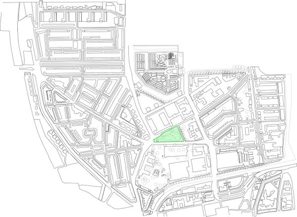
| | site map | | site map |
| | | | |
| | [[File:Map-final.jpg|600px|center]] | | [[File:Map-final.jpg|600px|center]] |
| − |
| |
| | | | |
| | [[File:Map final.pdf]] | | [[File:Map final.pdf]] |
| | | | |
| − | FUTURE PLANS | + | Surrounding buildings |
| − | | + | |
| − | <div style="float: left; width: 400px; ">
| + | |
| − | | + | |
| − | '''Extracted from the Zoningplan'''
| + | |
| − | | + | |
| − | '''Desired development'''
| + | |
| − | | + | |
| − | The northern area is a TU-important link between the old town and the Knowledge City Complex in the city and fulfill a social function relevant
| + | |
| − | to the whole city. If we develop TU-North there is the opportunity do strengthen this link.
| + | |
| − | On one hand you have the North with its new knowledge and development. And on the other hand, we have the historical center with its historical
| + | |
| − | and touristic attraction to the city center.
| + | |
| − | | + | |
| − | '''History'''
| + | |
| − | | + | |
| − | First de ‘Julianalaan’ was the important artery. But after a while the ‘Michiel de Ruijterweg’ became the most important route in the TU-area.
| + | |
| − | | + | |
| − | '''Possible interpretations'''
| + | |
| − | | + | |
| − | '''Catering and retail'''
| + | |
| − | | + | |
| − | The northern TU-area is an important link between the old town and the Knowledge City Complex in the city and fulfill a social function relevant
| + | |
| − | to the whole city. Conference facilities, hotel accommodations and catering facilities fit par excellence in this area. It will mainly considered
| + | |
| − | related to the TU, such as retail bookstore or student or related functions.
| + | |
| − | | + | |
| − | '''Public Space'''
| + | |
| − | | + | |
| − | ‘de Vries van Heijstplantsoen’ is of major influence on the appearance of the area. • maintaining and enhancing the Botanical Garden and the the
| + | |
| − | ‘de Vries van Heijstplantsoen’; • improving the availability and accessibility of the ‘de Vries van Heijstplantsoen’; • principle is that the space
| + | |
| − | around the buildings as a whole is organized, regardless of property boundaries; • valuable trees (groups) in the region have adequate space; •
| + | |
| − | accessibility and quality of the residence area is improved by introduction of new trails
| + | |
| − | | + | |
| − | '''Traffic structure'''
| + | |
| − | | + | |
| − | In the current situation is the Julianalaan a physical barrier between the faculty of Architecture and ‘de Vries van Heijstplantsoen’, but with
| + | |
| − | a renewed traffic structure it can be more like frontgarden of the building, or become more related to the Delft Science Center.
| + | |
| − | | + | |
| − | | + | |
| − | <div style="float: left; width: 1010px; ">
| + | |
| − |
| + | |
| − | SURROUNDING BUILDINGS
| + | |
| − | | + | |
| − | | + | |
| | | | |
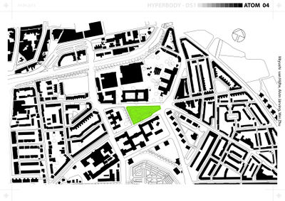
| | [[File:Map.jpg|400px|]] | | [[File:Map.jpg|400px|]] |
| − |
| |
| − |
| |
| | | | |
| | <gallery perrow="4" widths=60px heights=60px caption="Surrounding Buildings" > | | <gallery perrow="4" widths=60px heights=60px caption="Surrounding Buildings" > |
| Line 107: |
Line 61: |
| | | | |
| | File:Public buildings and departments.jpg|Public buildings and departments | | File:Public buildings and departments.jpg|Public buildings and departments |
| | + | |
| | </gallery> | | </gallery> |


