atom01:Resources
| Line 23: | Line 23: | ||
==Team== | ==Team== | ||
| + | ;[[Main_Page#Design_studio|You]]: | ||
| + | And us: | ||
;[[User:Joost|Joost Noorden]]: | ;[[User:Joost|Joost Noorden]]: | ||
;[[User:Koen|Koen Kegel]]: | ;[[User:Koen|Koen Kegel]]: | ||
| Line 28: | Line 30: | ||
<br> | <br> | ||
| − | + | Please use our [http://bit.ly/HyperPublicFeedbackForm feedback form] and help us improve. | |
| − | + | Public [http://bit.ly/HyperPublicGxls progress document] | |
| − | + | ||
| − | + | ||
Follow us on Twitter: [http://www.twitter.com/HyperPublicNL @HyberPublicNL] | Follow us on Twitter: [http://www.twitter.com/HyperPublicNL @HyberPublicNL] | ||
| + | |||
| + | Our website (under construction) : [http://www.hyperpublic.nl www.HyperPublic.nl] | ||
| + | : [http://www.twitter.com/HyperPublicNL @HyberPublicNL] | ||
</div> | </div> | ||
Revision as of 15:42, 10 October 2011
Resources
blabla
Contents |
Team
And us:
Please use our feedback form and help us improve.
Public progress document
Follow us on Twitter: @HyberPublicNL
Our website (under construction) : www.HyperPublic.nl
Concept
ONLY A DRAFT VERSION FOR NOW, ALL INPUT IS IN DROPBOX, NEED TO PLACE ON SITE ASAP!
////// How do we intervene //
/// static Intervention //
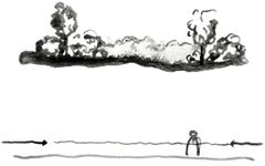
01. currently, the access to the site is intimidation due to the vegetation bordering the whole lot. The idea is to lift patches of this vegetation above the ground of the site and create sort of "plan libre" on the site.
02. The idea is to "cup" people that walk on the site. The "plan libre" created by the lifting of the vegetation would turn the site into a temporary space used simply to get to the bus, class, etc.
03. The protection from the rain enables people to use the space while it is raining, some may even use the object solely for that particular function.
04. The active topography gives a more entertaining ground floor and it directs people through the site.
traffic flow-->
slow traffic vs fast traffic current model, show images which make clear that the slow traffic flows can enter Science Center, BK City and the Hortus now.
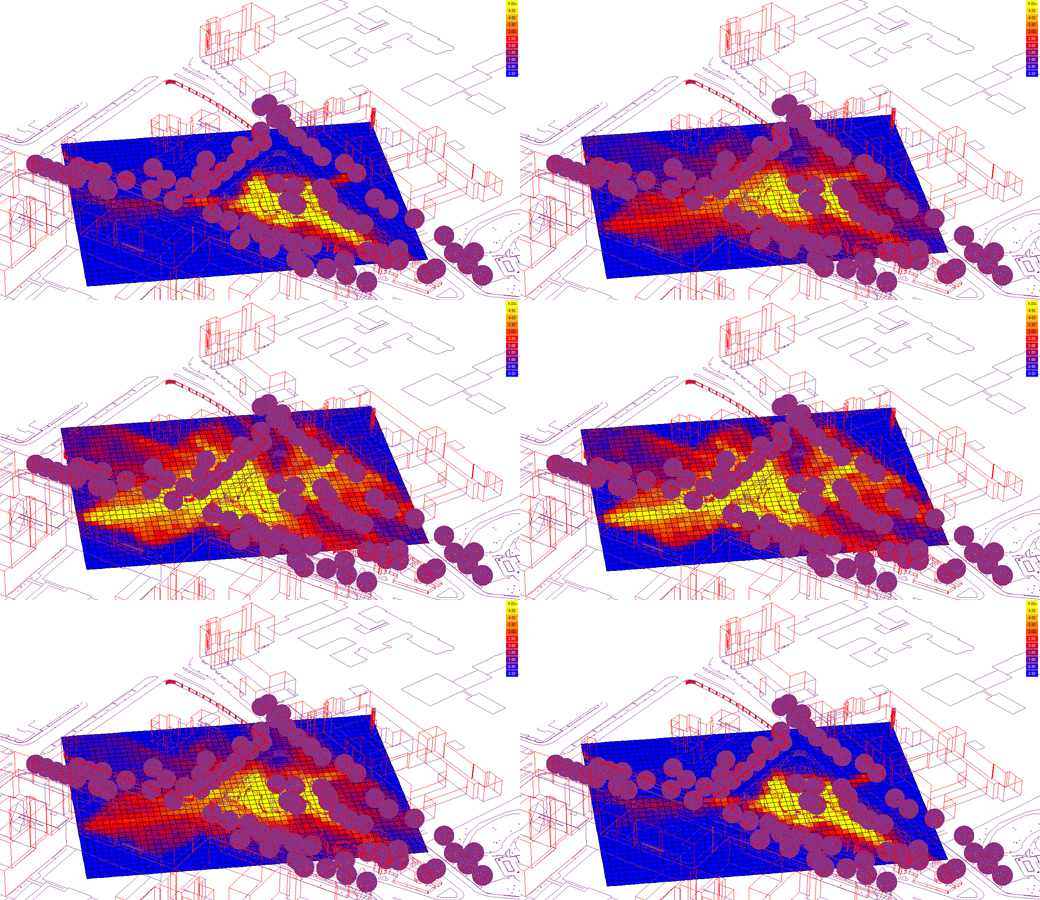
publicness / openness--> ecotect model
show not only the pictures, but also what variables we can filter from this analysis, so we can get new parameters like maximum and minimum building dimensions. Also show the best place to build our structure if we want to have maximum visibility, and show that it's also a possibility to keep the sightlines between the different existing surrounding buildings. These are the two clear options we need to make a dicision about: visible attractor at the center, or making the connection between the existing buildings stronger by visually connection them so more people will be drawn to the location where our structure will be as well?
Tools
ONLY A DRAFT VERSION FOR NOW, ALL INPUT IS IN DROPBOX, NEED TO PLACE ON SITE ASAP!
Show traffic flows in the future, where connections to Hortus, science center, bk city and the city itself are added.
References
ONLY A DRAFT VERSION FOR NOW, ALL INPUT IS IN DROPBOX, NEED TO PLACE ON SITE ASAP!

