atom01:Home
| Line 1: | Line 1: | ||
| − | <div style="float: left; width: 600px | + | <div style="float: left; width: 600px; margin-right:10px; text-align:left"> |
| − | + | [[File:banner1.jpg]] | |
</div> | </div> | ||
| − | <div style=" | + | |
| − | + | <div style="position: absolute; top: 100px; left: 600px; width: 300px; height: 300px;border:thin solid blue;" > | |
| + | |||
| + | '''Team''' | ||
| + | |||
| + | ;[[User:Joost|joost]]: | ||
| + | ;[[User:Koen|Koen]]: | ||
| + | ;[[User:Manon|manon]]: | ||
| + | position: absolute; top: 25px; left: 507px; width: 210px; height: 125px; | ||
| + | |||
| + | |||
</div> | </div> | ||
| + | |||
| + | |||
| + | |||
| + | {|border="0" cellpadding="10" cellspacing="0" align="left" | ||
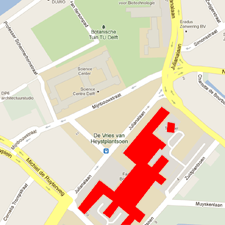
| + | |[[File:110912_High_res_location_gmap_bkcity.png]] | ||
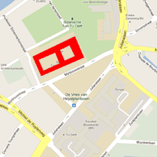
| + | |[[File:110912_High_res_location_gmap_sciencecentre.png]] | ||
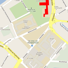
| + | |[[File:110912_High_res_location_gmap_hortus.png]] | ||
| + | |- | ||
| + | ! scope="col" width="250" style="background:#efefef;" | Questions | ||
| + | ! scope="col" width="250" style="background:#efefef;" | Stylos - BK City | ||
| + | ! scope="col" width="250" style="background:#efefef;" | Science Centre | ||
| + | |- | ||
| + | ! scope="row"; style="background:#efefef;" | The site will be mapped as a grid of points which drive a network of inflatable "bubbles" linked together by a network of valves so as one bubble inflate its neighbors deflate. | ||
| + | |text for row 1, column 1 | ||
| + | |text for row 1, column 2 | ||
| + | |- | ||
| + | ! scope="row" style="background:#efefef;" |row 2 | ||
| + | |text for row 2, column 1 | ||
| + | |text for row 2, column 2 | ||
| + | |- | ||
| + | ! scope="row" style="background:#efefef;" | row 3 | ||
| + | |text for row 3, column 1 | ||
| + | |text for row 3, column 2 | ||
| + | |} | ||
| + | |||
| + | |||
| + | |||
| + | |||
| + | |||
| + | |||
| + | |||
| + | |||
| + | |||
| + | |||
| + | |||
| + | |||
| + | |||
| + | |||
| + | |||
| + | |||
| + | |||
| + | |||
| + | |||
| + | |||
| + | |||
| + | |||
| + | |||
| Line 12: | Line 68: | ||
| − | |||
| Line 19: | Line 74: | ||
| − | |||
Revision as of 14:05, 23 September 2011
/// A HyperPublic Landscape //
diagram - Quick concept overview
////// What is the challenge //
How do one create a HyperPublic space? What does it look like?
Which brings ///problem 01//
How can a specific user be defined? Our first measure was to design a questionnaire which we presented to selected potential users and neighbors of the site.
////// Who owns it Who uses it //
The location and organisation of the site made TU Delft the obvious client, the new design will act as a central platform through which the university will display the outstanding work of its student body and it will act as an icon for the beginning of the campus.
Students and professors from TU Delft and around the world are our primary users, as well as the interested general public.
////// How do we intervene //
/// static Intervention //
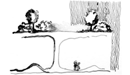
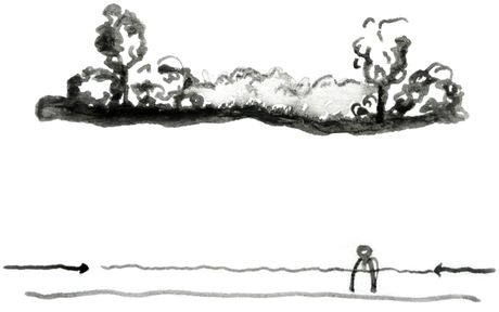
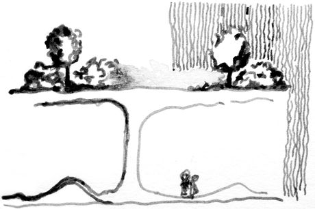
01. currently, the access to the site is intimidation due to the vegetation bordering the whole lot. The idea is to lift patches of this vegetation above the ground of the site and create sort of "plan libre" on the site.
02. The idea is to "cup" people that walk on the site. The "plan libre" created by the lifting of the vegetation would turn the site into a temporary space used simply to get to the bus, class, etc.
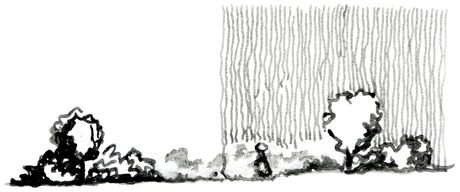
03. The protection from the rain enables people to use the space while it is raining, some may even use the object solely for that particular function.
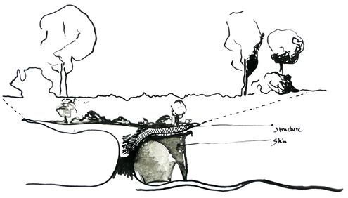
04. The active topography gives a more entertaining ground floor and it directs people through the site.
/// Dynamic - Interactive Intervention //
The skin of the structure grows and retract to adapt to its required functions, very much like the plants all around adapt to seasons to survive.
/// (Public) Progress ///
01.
